 Location Taken: See below.
Time Taken: June 2010
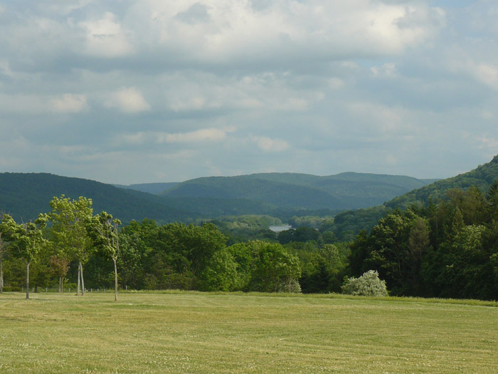
I honestly am not certain exactly where this was taken. My memories state it was a rest area in New York state. The roads we took then would place it on Northbound I-81. The photos taken around it place it in southern upstate New York. And yet, when I go look at all the rest areas in southern New York on I-81, none of them match the geography in the picture. Either the list of rest areas I was working off of was incomplete, or my memories are off. And, given how strong my map sense is, I’d doubt the list first. But I haven’t found a more complete list.
I really do have a strong sense of where I am. I have never gotten lost. I have gotten turned around, pretty much only when I’ve just switched over to a shift of driving directly from a nap, such as the time I took the exit heading to Harrisburg, PA when trying to head west from Breezewood, PA – which, if context clues have failed you, means I was heading east. My brain just saw “Harrisburg”, said “that’s more to the west, isn’t it?” (since the route I take more often through Pennsylvania is way to the east in the state), and ignored the fact that Harrisburg’s really in central Pennsylvania, if anything more east of center. Even then, I figured out that I was going the wrong way within miles, by noticing that the sun was coming from the wrong direction. Yes, the sun. *geek cred attained* I wouldn’t exactly call that lost, and that’s the closest I’ve ever come to being lost.
A lot of this ability to know where I am comes from a natural obsession with maps. Before I go anywhere unfamiliar, I love checking the maps of the area, figuring out the layout of the land and roads. I’m also really good at correlating what’s on the map with what’s in the world. It’s one of those natural things. Another natural thing is the ability to memorize the roads very quickly and accurately. I only need to head to a place once (by following directions) before I’ve got it memorized, with maybe an additional one or two times required if it’s highly complex or easily confused with other areas.
That’s what’s causing my confusion for this picture. Rest areas aren’t exactly distinct enough to tell apart just from the layout. They’re designed to be somewhat similar, since they all have about the same services provided, plus the need to be easily navigable to weary travelers. Mind you, there is some distinctiveness in building design. If I had a picture of the outside of the building, I’d be able to narrow it down more. But the layout of the road area? The only difference is whether it’s surrounded by grass or forest, and how much of a slope there is. The on-ramps almost always look the same, as does the parking lot. Some states have more varied layouts (the rest areas on the Ohio Turnpike have a different look than the ones on the east coast of the US), but it’s always designed with function and efficiency in mind. Which leads to things looking similar, alas.
I always get a little irritated when I can’t place a photo. You may have noticed that I include a link to the actual latitude and longitude of the place the photo was taken right below the photo. That’s more for me than for any readers. I delight in figuring out where something was taken, so I can figure out what I’m looking at. Already, several of my posts have had their content stem from that. I hadn’t a clue about the Manitou Islands being a volcanic pipe, or the history of Chimney Island, before I started researching what those islands were names.
I would have loved to do the same for the lake in this picture.
Instead, it shall stay nameless, at least until more research (or another visit to that rest area) reveals it to me.
