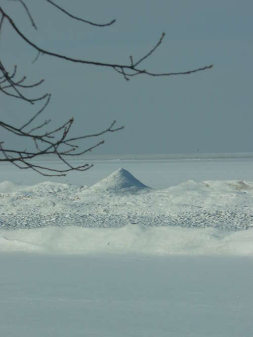
 Location Taken: Caseville, Michigan
Time Taken: January 2011
I was flipping through my photos and noticed that this one could be rather misleading.
So, have any clue what it is?
I know what it is, so I have trouble seeing it as anything else, but I could still manage to mentally flip between two images.
The real question is, how close is that peak?

Given the tree branches, you must be on the high ground above the beach. Let me guess 15 feet from the beach. The first ice ridge is usually 30 feet out the frozen lake from there, and the second ice ridge is usually 20 to 30 feet past that. Let me guess 65 feet away.
That ice peak is only about six feet tall. The ice ridges are formed by the waves as Lake Huron freezes over in early winter. Sometimes an inlet in the ice ridge channels the waves to splash upward, so the ridge acquires a peak that is much like the volcanic splattercones at the Craters of the Moon National Park.