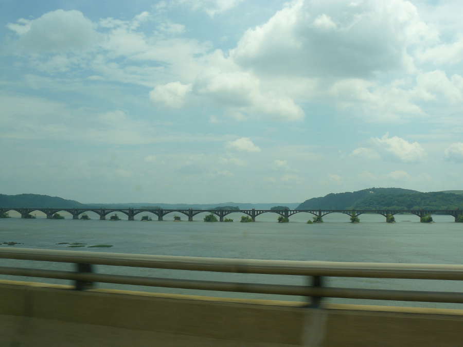
 Location Taken: Pennsylvania, USA
Time Taken: June 2010
Where US Route 30 crosses the Susquehanna River not far from the Pennsylvania-Maryland border (or the Mason-Dixon Line, if you prefer), there are a whole slew of bridges crossing at the same spot. I’m particularly fond of the railway bridge to the east, with its many fine arches and the row of small islands, each with its own tree, likely a remnant of an older bridge that was removed at some point.
I’d prefer it if it was easier to get a photo of. The only place to get this angle is while you’re on 83, and well, stopping on a busy interstate bridge just for a photo is, shall we say, frowned upon. At least there’s a shoulder, but it does mean that the railing’s even more likely to get in the way of the photo. And motion blur is rarely your friend when trying to take a picture of a landscape.
The Susquehanna River comes from a place hundreds of miles to the north, well north of the New York-Pennsylvania border. The main branch starts in Lake Ostego, a small glacial lake about halfway between Syracuse and Albany. I run across it where Interstate 81 crosses it, at the town of Great Bend, PA, right at the border. It’s named after the way the river bends across the land near there. The river is much smaller there than it is in this photo, still just starting its long trip to the sea, one that winds its way through the Appalachians, visiting Wilkes-Barre and Harrisburg, comes down into the Chesapeake Bay and finally exits into the Atlantic a bit south of the Maryland-Virginia border. Well, it’s more like it becomes the Chesapeake. The Chesapeake Bay, like many of the bays along the East Coast, is a flooded river valley. Back in the last ice age, the seas were much lower. All the water that went into the glaciers that covered so much of the land (including the areas where the Susquehanna now starts) had to come from somewhere. And since glaciers aren’t static things, they have a constant cycle of melting and renewal, the water flows down and forms river valleys, frequently deep ones.
As soon as the glaciers started to retreat, though, these river valleys were in for a change. Some of them had their rivers all but dry up, leaving a tiny stream winding its way through a massive valley. Others are doing just fine, still making their way along the old path to the sea. Which is where another change occured. Their old deltas are now far underwater, the new ones far upstream. All those fantastic bays that lead to so many fine fishing towns and settlements along the East Coast are due to 10,000 year old climate change raising the sea levels, bringing the water deep inland.
